|
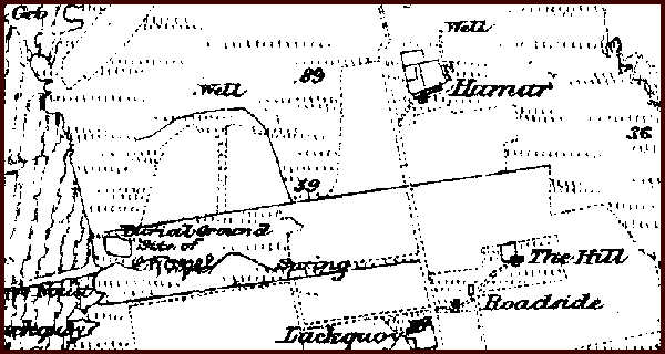
Introduction / The Island / Religion ChapelThe Ordnance Survey map from the 1880s / 1890s indicates the site of a chapel near Kirk Noust. The OS name book from the time of the preparation of that map speaks of it being an “ancient chapel in the south east corner of the burial ground.”
From the recollections of Mary Groat (1871-1940), it was close to where the old house of the Bu stood. She had recollection of part of the chapel still standing when she was a child. There was a fountain made out of a black stone that was finely dressed with flowers that were cut along its edge that had been used for baptisms. It lay beside the ruins but she did not recall what happened to it. It is also understood that it had a blind window to save on the “window tax” that applied from 1696 up to 1851 and was then replaced by “house tax”. It is possible that this could have been a window with a flagstone sill. A story goes that if someone had transgressed then they were set in the window space for three Sundays with a sieve on their head. The last of the remains of the chapel was used to build a dyke around the burial ground in 1925. | |||||