 | ||||||||
|
Introduction / Houses Bull (or Bu)
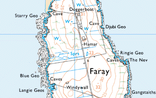
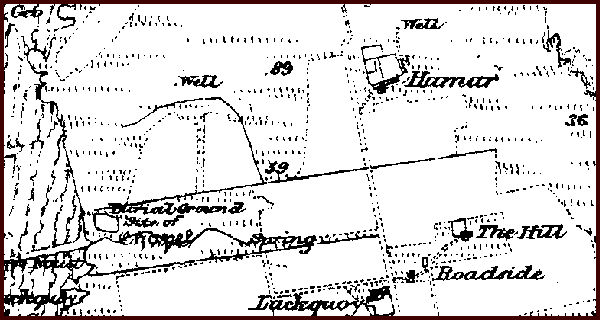
The lands of the Bu, as it was generally known, extended to some three acres and fell between Hammar and Lakequoy. (Lakequoy itself, which is indicated on the map alongside but not named, lies just on the west side of the road, south of Hammar). The Bu was enclosed by a stone dyke. Bull appears in the rental of 1810 when the tenant was William Hercus who also had the tenancy of Lakequoy. James Stewart of Brugh, who owned Pharay, subsequently used the Bu as a summerhouse. This was a considerable dwelling as consisting of two storeys. It is likely that it deteriorated and the laird stopped coming for it then occupied John Drummond and his wife Janet Reid, together with their family. They were there for some before the 1841 census. In the census, it was again recorded as Bull. The Bu land became part of both Hammar and Lakequoy at the time of the “planking” (end of the run-rig system), sometime between 1841 and 1851 and the building was taken down. John Drummond was allotted land at the south end of the island and a house was built there, which he called the Ness. That house first appears in the census of 1851. The Bu building lay close to the chapel as Mary Groat (1871-1940) who was at Lakequoy remembered, as a child, part of the church was still standing.
A generation later when Mary’s son was farming at Hammar, the field where the Bu stood was still known as the "Bu land" and the plough would “dilder” as it went over the stones where the building had stood. | |||||||


